![]() |
#311
|
|||
|
|||
![]()
Using modern SRTM data provides an excellent and fairly quick start. Having done that its fairly easy to overlay historical maps in photoshop to adjust coastlines and river lines.
Getting the position of road and rail and urban boundaries right is not so easy due to the limitations of the game engine. The best you can aim for is just to get the right feel. The biggest contribution to the appeal of a great map is probably the production of new artwork for ground textures and the inclusion of bump maps. This is part of the Rabaul map by Bee. (still WIP) ![]() Last edited by Asheshouse; 01-09-2014 at 07:18 PM. |
#312
|
|||
|
|||
![]()
Looks good Asheshouse! Is that from the Team Pacific N-G map?
The thing that 4.13 and beyond really need are some great new maps. I see lots of stuff in development that go into Mod packs but I really wish they would make sure they were ready to go (no copyrighted textures, etc.) and offer them up for inclusion in an official map. We need stuff for online dogfights, offline campaigns, online campaigns, etc. We have a good selection but there are, of course, more out there.
__________________
Find my missions and much more at Mission4Today.com |
#313
|
|||
|
|||
![]()
Asheshouse is right about SRTM data. A map could be built quickly from them. The difficult, or better say, time-consuming part is what follows. In particular, detailed maps with historical airfields and dedicated buildings and textures (e.g. Slovakia) may take a many-people team years of research and work.
On the other hand, I guess that adding another generic-looking map with textures and buildings from the current stock game will rise lots of eyebrows to say the least. My (personal) two cents.
__________________
![]() |
#314
|
|||
|
|||
![]()
Hope to see soon new development update
|
#315
|
||||
|
||||
![]() The image above is from the Rabaul map I'm working on. I haven't seen anything from the PNG group for some years. The above map was originally an abandoned early alpha from a Japanese group. It's accuracy was very poor and I've been working to get it right, down to the individual named streets in the township. Using period maps, strike photos and topographical information I've also been able to reproduce the damage to airfields and installations, to represent how the area looked in 1944 when it was under seige. It's strictly a mods-on prject though, and utilises techniques and resources outside the default game. Some more pics from various stages in the map's development if you're interested. ![]() ![]() ![]() ![]() ![]() ![]() ![]() 
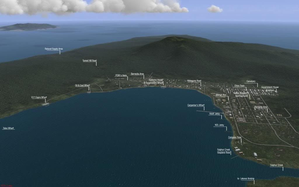
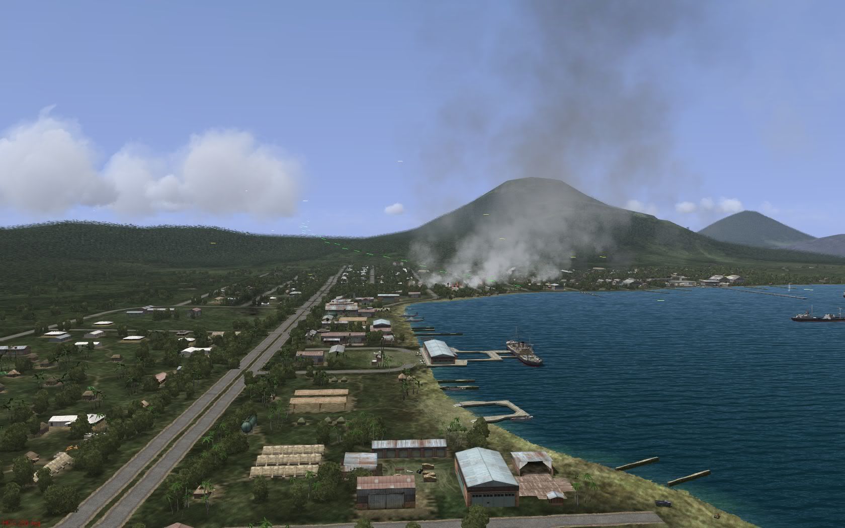
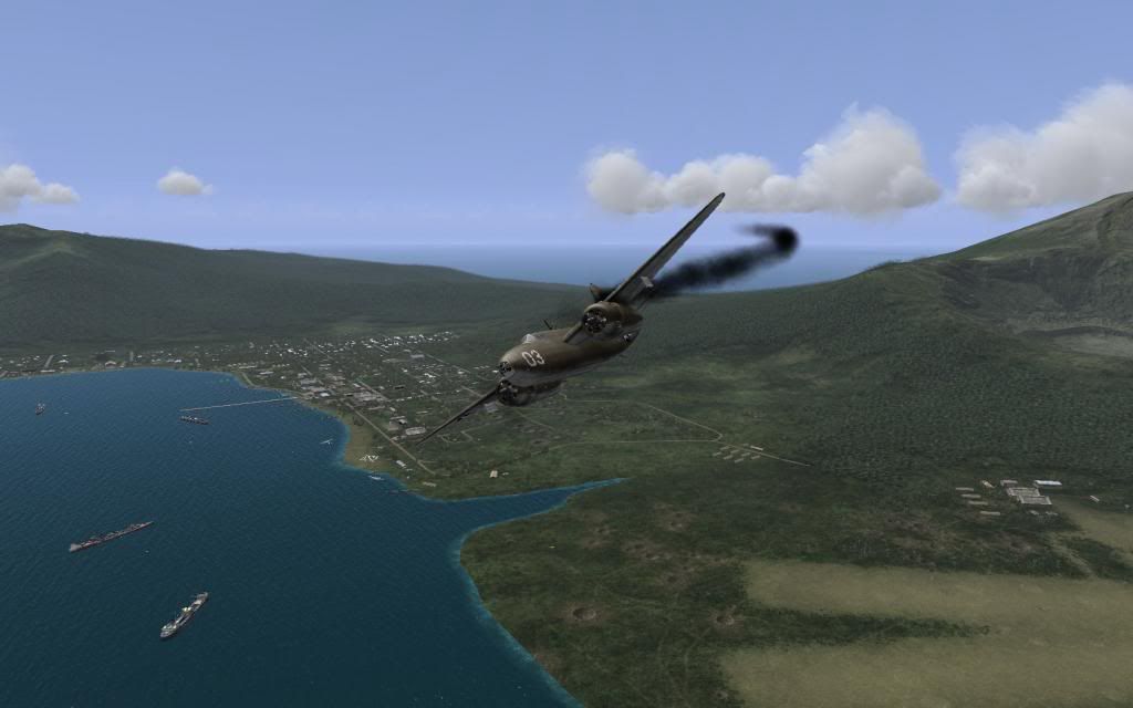
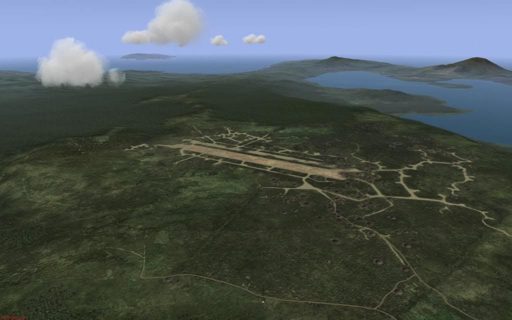
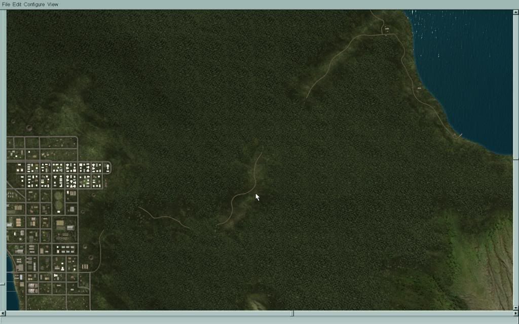
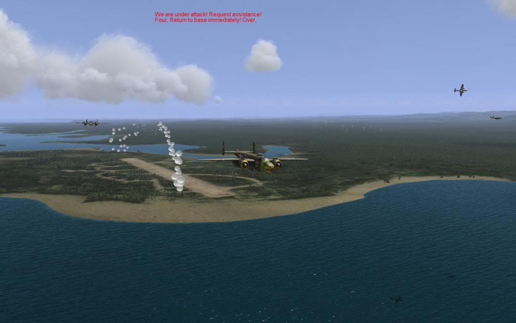
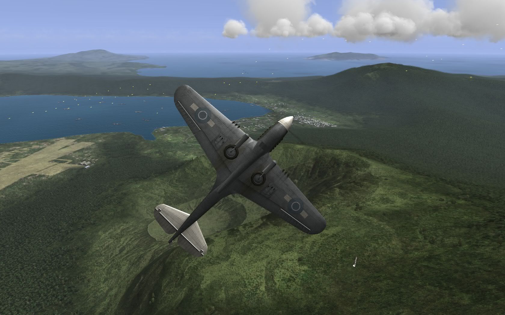
Last edited by Feathered_IV; 01-12-2014 at 11:59 AM. |
#316
|
|||
|
|||
![]()
I'm disappointed to hear its a MOD only product... but it certainly looks stunning.
__________________
Find my missions and much more at Mission4Today.com |
#317
|
|||
|
|||
![]()
That looks AWESOME Feathered IV!!! Can't wait to see it in game.
![]() |
#318
|
|||
|
|||
![]() Quote:
__________________
Bombing smurfs since a long time ago... |
#319
|
|||
|
|||
![]()
Feathered_IV -- can you say what the copyright status is of the ground textures which you are using. I understand that you are generally not using stock textures. Are they original artwork?
I guess the build relies on "modded" objects, or re-skinned stock objects? -- but I guess that need not be a major problem. The curved roads which appear in some of the images will not permit automatic route tracking in FMB, but they do look much better than the stock linear roads. Last edited by Asheshouse; 01-12-2014 at 02:29 PM. |
#320
|
|||
|
|||
![]()
For a map like Rabaul, the inability to get vehicle columns to track properly isn't that much an issue, since the main targets of Allied strikes on Rabaul were Japanese airfields/aircraft and shipping.
|
![]() |
|
|