
|
|
#441
 04-26-2010, 03:23 PM
|
|||
|
|||
|
Community arround FS X is wonderfull. Are you planning to use the engine for Civil Aviation? Make Airbus 320, nice 3D cockpit, some ILS airports etc? It could be amazing for flying community... Thanks for answer.
|
|
#442
04-26-2010, 03:48 PM
|
||||
|
||||
|
Ciao Oleg Maddox this is another important movie of LUFTWAFFE in ACTION in BATTLE OF BRITAIN
another important video regards BATTLE OF BRITAIN original document real war loock whit actenction the explosion the smoooke and the tecnic of attak and the real effect this is very goood video and real document of real pilot's |
|
#443
04-27-2010, 05:19 AM
|
|||
|
|||
|
It would be nice to make a normal navigation. Before the start of mission player can make a way points and game calculate distance between this points, speed, altitude, course and time of flight. Than player open in game map, he can watch all parameters of flight. I think this would be nice especially for bombers. Sorry for my bad English, I study it 5 years ago at school.
|
|
#445
04-27-2010, 12:30 PM
|
|||
|
|||
|
I mean offline game. For example, you play bomber mission. You create a points betwen your field and target. Distance from your field to first point 30 miles. Your speed - 300 miles\hour. So, you can fly this 30 miles for 6 minutes. You write near the point on map this numbers, and press start. In game open map and see how much time you must fly to point. For hardcore players it must be handle, for inexperienced players it can be automatically. My idea not actually for online, I just say about offline gamers who like long distance fligth on bombers, just like me.
|
|
#446
04-28-2010, 11:35 AM
|
|||
|
|||
|
You can already do that. Print the map, grab a ruler with angles and a pencil, a stopwatch and a scratchbook, why to stop at doing it at the screen?
 Some people do that. Only way to navigate in bad enough weather, above the clouds, in a bomber. Just not in a typical server. |
|
#447
04-28-2010, 07:05 PM
|
||||
|
||||
|
dear Oleg Maddox in il-2 the pilot for the navigation have only map and virtual stear point.
in WW2 for the navigation pilots have important instrument loock photo  U.S. ww2 rules loock this link 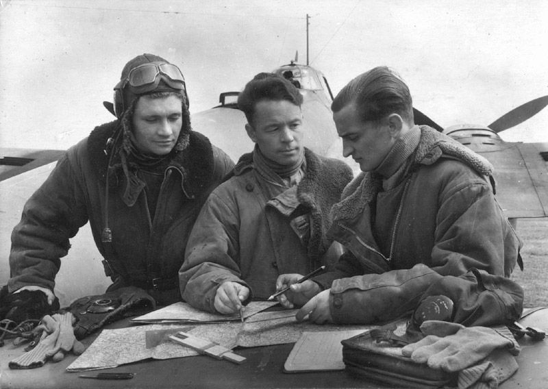 russian pilots prepare briefing whit map and rules. |
|
#448
04-28-2010, 07:14 PM
|
||||
|
||||
|
could be possible to create ,in the briefing a tool for paint in the maps ( just for coops, and server could desactivate this)
|
|
#450
04-29-2010, 04:56 AM
|
|||
|
|||
|
Quote:
One of the problems is printing the map in an appropriate scale. Having measuring tools (rule/protractor) and a way of making notes on the map window within the game would be useful for navigation in SOW. Cheers! |
 |
| Thread Tools | |
| Display Modes | |
|
|


 Linear Mode

